If you have a photo you’d like to share, e-mail it to claychamber2017@gmail.com and we’ll use them as we’re able. As a part of your e-mail, please give us written permission to use it as we see fit.
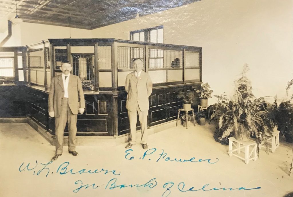
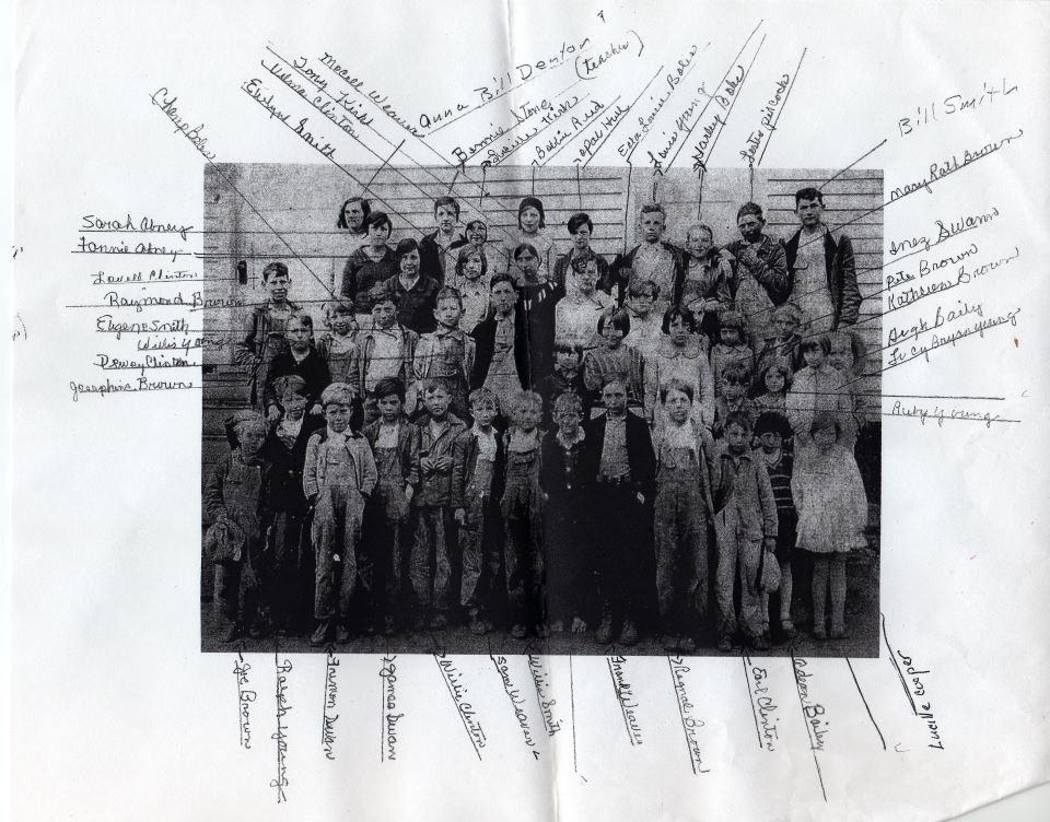
The handwriting on the photo tells the story here.
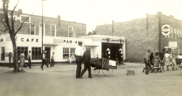
Not much known about this photo, except that it appears to be a parade, obviously in Celina. Looking at other photos of the same event, it would be circa 1940’s (based on automobiles), maybe early 1950’s.
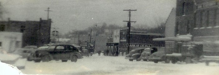
Also don’t know much about this photo, but there was a little winter weather going on in Celina.
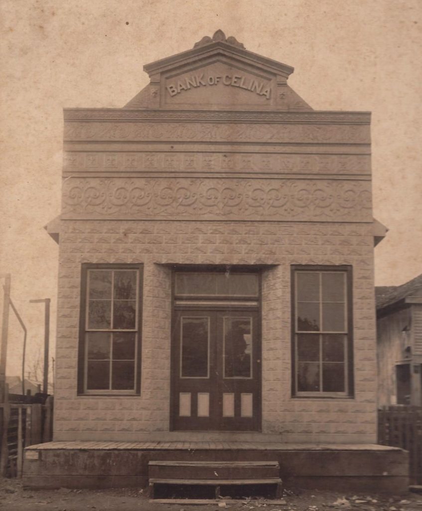
Our banks and many other businesses have been in many different buildings in different parts of the county seat.
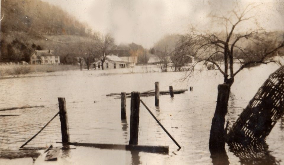
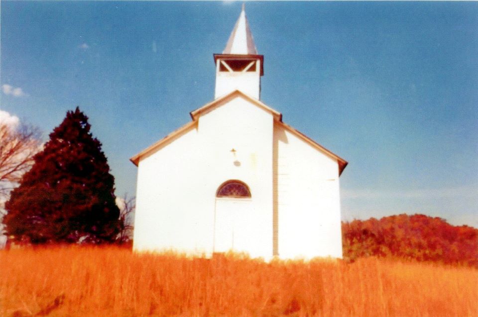
BUTLER’S LANDING SCHOOL – Someone identified everyone in this decades-old photo. A flood in the Butler’s Landing area, date unknown, but almost certainly pre-Dale Hollow Dam. Part one – Church building in the Tinsley’s Bottom area of Clay County.
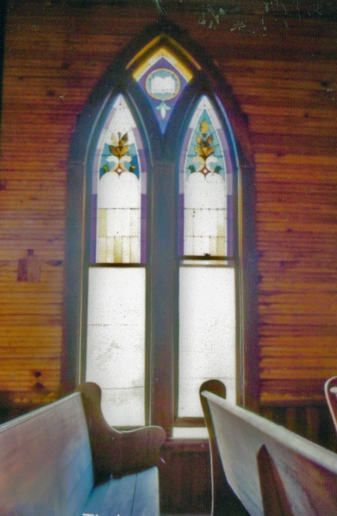
Part two – A beautiful stained-glass window inside the church building in the Tinsley’s Bottom area of Clay County.
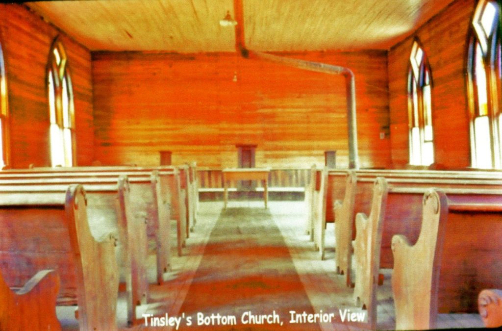
Part three – Interior view of the church building in the Tinsley’s Bottom area of Clay County.
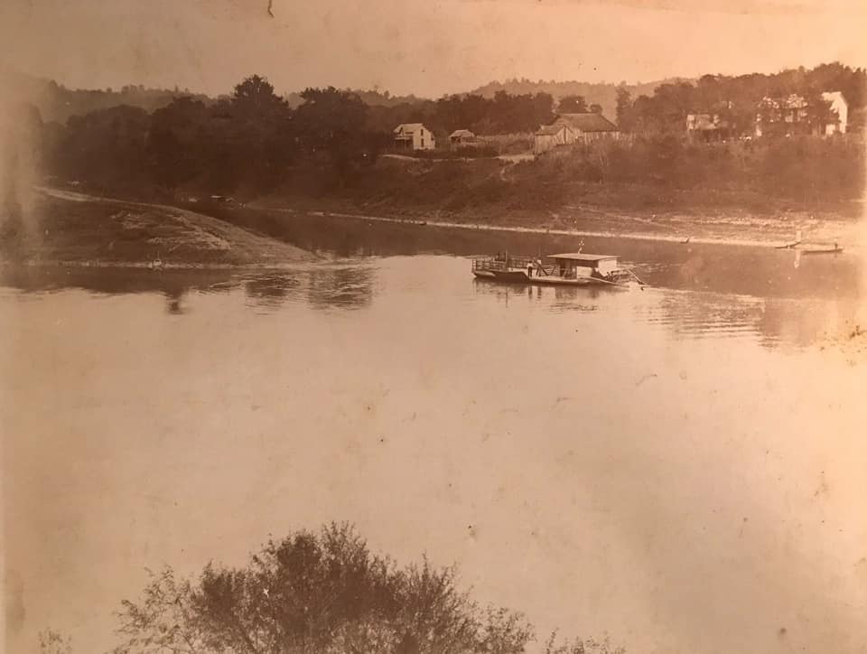
FERRY NEAR CELINA – The ferry closed after the Henry Horton Bridge was completed in 1930. Clay County was bisected by the Cumberland River with no bridge across it for the first 60 years of the county’s existence. (Photo courtesy Johnny McLerran)
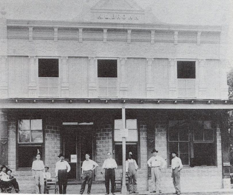
W. L Brown store in “old town,” Celina, TN. Mr. Brown is shown above in the top photo on this page, and possibly at the left side of the door in this photo.
For more vintage photos and information, visit us on FACEBOOK.